Friday, December 24, 2010
Thursday, September 30, 2010
Thursday, September 23, 2010
indrajatra
Kumari, the living goddess, entering the special chariot during the Indra Jatra festival at Bashantapur in Kathmandu
Indra Jatra
It is a well known fact that Hinduism and Buddhism are the two major religions of Nepal, each having it's own rules and rituals. However, like most festivals of Nepal, both Hindus and Buddhist unite to celebrate the festival of Indra Jatra. This festival is celebrated by both Hindus and Buddhists with great enthusiasm. It is also believed that Indra Jatra is a festival of classical dances. It is on this very day when one is able to observe numerous varieties of traditional dances. The festival is named after Lord Indra who is known as the god of rain and also as the king of heaven.
The festival of Indra Jatra continues for eight days with much rejoicing, singing, dancing and feasting. People from all over Nepal, mostly those who live within the Kathmandu Valley, gather at the Hanuman Dhoka in Kathmandu. The first day of the festival is viewed by a large number of people. On that day, a long wooden pole is erected in front of the ancient Royal Palace at Hanuman Dhoka, in order to propitiate Lord Indra, the"god of rain". Classical dancers also assemble at the spot, wearing different kinds of traditional masks and costumes and dancing around the courtyard of Hanuman Dhoka to celebrate Indra's visit.
Friday, September 10, 2010
Wednesday, September 1, 2010
People in the rain - Kathmandu - Boudhanath Stupa - Nepal
People in the rain - Kathmandu - Boudhanath Stupa - Nepal
Rain in Patan
we were there for the start of the monsoon....the rain wasnt so bad though it never rained for very long.
Escaping rain
The pre-monsoon rain showers on Pashupatinath. This group of three - two girls and their guardian - were soaked wet when I first saw them , and the girls kept on running in and out of the rain.
Monday, July 5, 2010
Prayers
Nepal. High above Namche Bazar.
The monks had climbed upto this rockface fairly recently This is the result of their efforts.
Nepali man waking in rice fields during rainy season
Nepali man waking in rice fields during rainy season
Nepal - Himalaya foothills
An aerial view of the Himalaya foothills in Nepal at the end of September 2007. The flooded rivers, brown with silt, are typical of the Monsoon rainy season, which comes to an end in October. Because of the rains the scenery is very green. Some reflection on the right from the airplane's window pane.
Nepal - Valley of Eternity (Ripuk, Barun Valley)
Ripuk is a local name for one of the places in Barun Valley (Nepal) where locals setup their temporary seasonal settlements.
Centuries ago, the river Barun used to be a glacier here, flowing to the north composing this lush green valleys for today. The height of the cascading waterfalls against the rugged and stiff mountains reflects the sense of the flow of time and eternity at the same time
tibetan man in muktinath
shot with a canon d30 and a 17-35f2.8 lens. holding a white/gold reflector in my left hand to illuminate his face. this is early morning at 3800m altitude, hence the special light. muktinath is a hindu pilgrimage, in the lower mustang, just north of annapurna. this man fled from tibet with the chinese invasion to the mountains of mustang and nepal.
the white in the blurry background is snow from the annapurnas
Terrasses
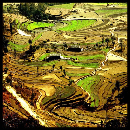
A view of terraced agriculture in the region Damphus. At this time of year (February), wheat (light green), potatoes and lentils (dark green) are in the spotlight. Later, when the monsoon will be rice.
A view is terrace cultivation landscape near Damphus. At this time of the year (february), There Are Mostly wheat (light green), potatoes and lentil (dark green). Later, in the monsoon, it Will Be rice.
Tengboche, Himalayas
Tengboche, Himalayas - Nepal
by Murat SELAM ©
Tengboche is a village in the Khumbu region of eastern Nepal, located at 3,867 metres. Tengboche has a panoramic view of the Himalayan mountains, including the well known peaks of Tawache, Everest, Nuptse, Lhotse, Ama Dablam, and Thamserku.
10 August 2009 - World Wildlife Fund (WWF) used this picture in the following report which explains new found 350 species in Himalayas.
Friday, July 2, 2010
Nepalgunj Airport Security
Just as muggy as the photo impresses, I captured this sunrise while waiting for a flight to the impressively rural Dolpa district. Shot in the city of Nepalgunj, a transport hub for Indian goods destined for central and western Nepal.
Artistic liberties taken: lightened shadows, played with levels, and increased saturation.
A house among the paddy fields in Surkhet district, western Nepal

A house among the paddy fields in Surkhet district, western Nepal, originally uploaded by lauraeldon.
Oxfam runs public health and basic livelihoods programmes in this remote region which is one of the poorest in the country.
Rara : Panoramic
Almost a year back from my adventurous trip to a distant heaven of Nepal, filled with nostalgia, I'm glad to share this shot to you all.
Needless to say, this is still the most amazing place I have ever been. :)
Karnali Bridge, western Nepal
The 500 metre Karnali Bridge crosses the Karnali River in a remote part of western Nepal. Built by the Japanese, it was inaugurated by Nepal's Prime Minister, Girija Prasad Koirala, in December 1993. The small village on the far side is Chisapani. The road is the Mahendra Highway, a main east-west link through Nepal's terai region. Photo taken in December 2009.
One of my best photo
This is the longest suspension bridge of Nepal which connects two village development Committees of Mahakali zone called "Dodhara & Chandani". This is one of the best photo of my gallery.


